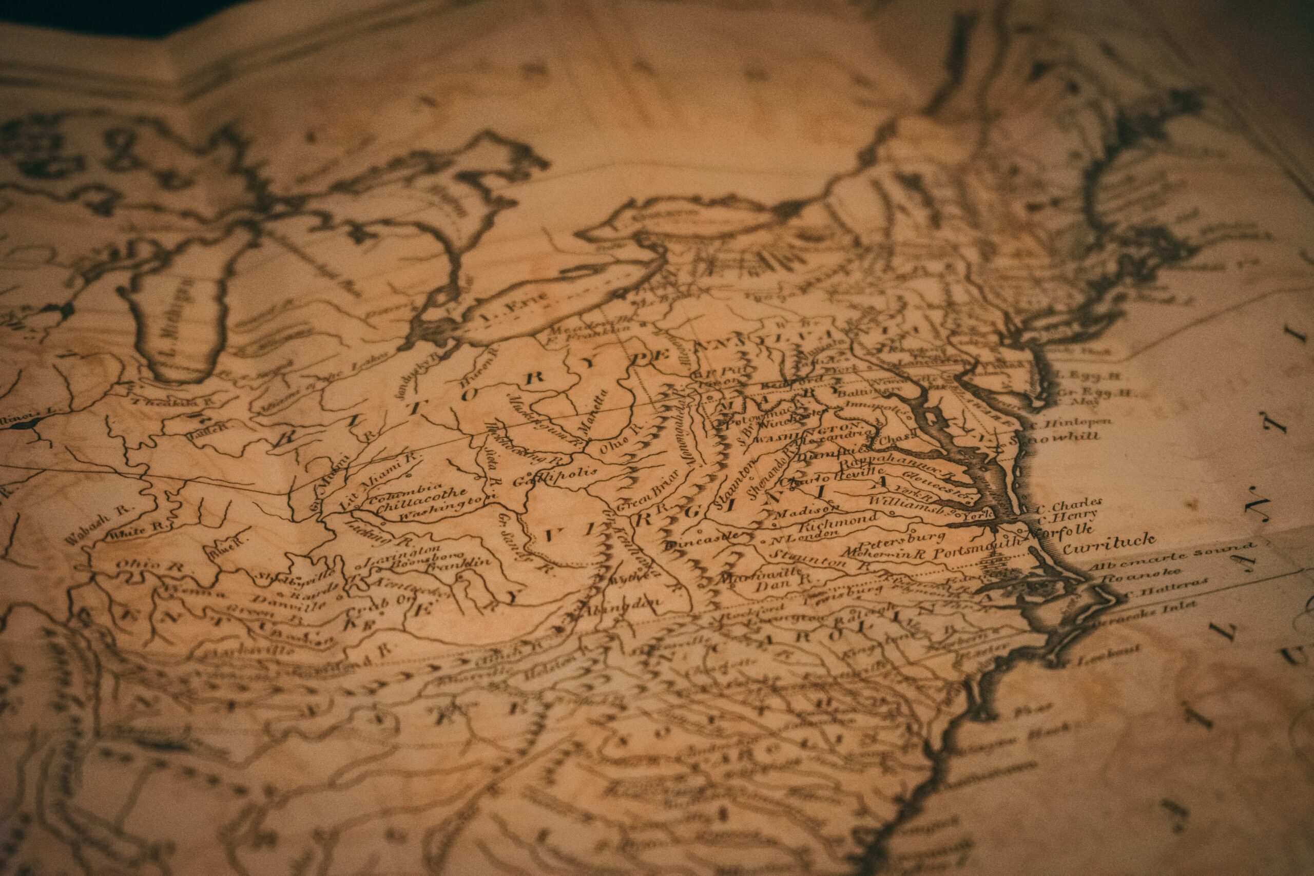
On al-Idrisi’s south-up maps, the Red Sea takes a moment to settle into a familiar shape. The water is recognisable, but the eye wants to rearrange the world around it. That small hesitation is a useful beginning for thinking about Arab cartography. Before we consider what an old map knows, we have to notice what we have brought to it: the expectation that north belongs at the top, that a coastline should resemble a satellite image, that a named harbour must have been understood in something like the way we understand it now.
At sea, those assumptions become practical. Recognising a coast and knowing how to approach it are different achievements. A mountain can identify the land beyond doubt while telling us almost nothing about the reef between that land and the yacht.
For Naora, the Red Sea belongs to a worldwide expedition, but it asks for more than another line on our route. Its history makes us reconsider what that line represents. Long before our arrival, people were describing these waters because their livelihood, obligations and safe return depended on understanding them.
Arab Cartography Connected Journeys Before It Fixed Coastlines
The ninth century is a meaningful point in this story, though not because every present-day Red Sea port can be shown on a map from that period. Ibn Khordadbeh, writing in that century, organised information about routes, places and the distances between them. His geographical world was connected through movement: administrative travel, trade and the practical business of reaching somewhere from somewhere else.
Al-Masudi belongs principally to the tenth century, not the ninth. His geographical and historical writing drew on travel as well as information gathered from others. That distinction matters. A description of a sea could contain personal observation, inherited learning and a traveller’s account within the same work. It was not necessarily a set of sailing directions, and the author was not necessarily the person who had tested an anchorage.
Arabic provided a shared language for scholarship across a world whose people cannot be reduced to one modern nationality. Greek geographical ideas were translated, examined and extended alongside knowledge generated through travel and exchange. Calling this Arab cartography should not make us imagine an isolated tradition, complete in itself and simply waiting for others to catch up.
Its strength lay partly in connection. A route carried more than cargo. It carried descriptions of water, settlements, distances, winds and the circumstances of arrival. Some knowledge entered written geography; some remained with people whose work required them to remember it.
We recognise that distinction aboard a yacht. The route plan tells us where we intend to go. The passage plan has to explain how the next part can actually be sailed.
Al-Idrisi Assembled A World In Sections
In 1154, al-Idrisi completed the geographical project prepared for Roger II of Sicily. Its mapping was organised into seventy regional sections across seven latitudinal belts, traditionally called climates. These were divisions of the inhabited world, rather than seven categories of weather in the modern sense.
The sectional arrangement matters more than a claim that this was simply the most accurate map ever made. A world assembled in parts allowed places, routes and regional relationships to receive attention that a single small outline could not contain. It was an ambitious act of comparison and organisation. It was also dependent on uneven knowledge.
A coast could be well understood as part of a trading network while its outline remained distorted. A journey measured in days might connect two places reliably without establishing the distance between them in Nm. Wind, vessel, stops and the purpose of travel all changed what a day’s movement meant. Multiplying an old travel time by an assumed speed does not recover a surveyed position.
The south-up orientation is equally worth treating carefully. It appeared in important strands of Arabic mapping, but was not a universal rule. Nor does the orientation alone establish that southern places were considered more important. North-up is a convention too, so familiar now that we often mistake it for a property of the Earth.
For us, the useful experience is to let the unfamiliar arrangement stand for a while. Do not immediately rotate it into obedience. Look instead at which places are connected, where the sea narrows, and how a harbour acquires meaning through what lies inland or across the water. The map begins to reveal the questions its maker was trying to answer.
A Port Name Is Not A Harbour Survey
Ayla, associated with present-day Aqaba, and Jeddah belong to long histories of movement around the Red Sea. But the appearance of a name in geographical writing proves something more limited than the existence of a navigational chart. It tells us that a place was known within the account being made. It does not tell us that its entrance had been sounded, its reefs positioned or its holding ground examined.
This is why the claim that every Red Sea port has been mapped since the ninth century asks more of the history than it can support. Settlements developed differently. Harbours changed in importance. Names shifted, and the place described by an old name need not coincide exactly with the modern waterfront carrying its successor.
The more interesting continuity is human. Jeddah’s role in pilgrimage helps explain why its harbour mattered far beyond the coast. A port serving travellers had to connect arrival by sea with onward movement, shelter, provisions and the rhythms of life ashore. Its significance cannot be reduced to the convenience of an anchorage.
That is something we can still lose by looking only at a chart. The chart quite properly gives priority to navigable water, hazards and the geometry of an approach. It has little room for the reasons people have been arriving there for centuries.
Old geography and modern hydrography therefore answer different questions. One may help us understand why the harbour exists. The other helps establish where the yacht can safely move. Neither becomes more valuable by pretending to do the other’s work.
The Knowledge A Pilot Needed
On a bright Red Sea approach, the coast can seem sharply legible while the water remains difficult to read. Dry slopes hold their shape in the hard light. Reflections break across the surface, and narrowing your eyes does little to resolve what lies beneath them. A pale patch may suggest shallower water, but glare, bottom colour and the angle of the sun complicate the judgement. Recognition is not yet permission to continue.
For a coastal pilot, useful knowledge had to reach beyond the name of the destination. Which feature identified the approach? Where did shelter cease to be shelter when the wind changed? What could the seabed tell a sounding line? How far could the vessel proceed before turning away became difficult?
A weighted line could measure depth, and a tallow-filled recess in the base of a sounding lead could bring up a small sample of the bottom. Sand or mud offered information that a depth alone did not. The sample was evidence from one position, however, not a description of an entire bay. That limitation remains familiar when judging an anchorage today.
Weather made this knowledge seasonal. In the northern Red Sea, winds from the north and northwest are common through much of the year. Farther south, southeasterly winds occur frequently in winter, while summer more often brings northwesterlies. These are regional tendencies, not instructions that can be applied unchanged to every passage.
A southbound course may be helped by one part of that pattern and opposed by another. Wind funnelled by coastal terrain can differ from the broad forecast, while waves retain the influence of weather beyond the water immediately around the yacht. A useful description of a route must therefore contain the conditions under which it works.
The cost of local knowledge was time: repeated passages, observation and the willingness to remember where an apparently reasonable decision had proved uncomfortable. A modern forecast gives us advantages earlier sailors did not have. It does not remove the need to ask what the wind will do to this particular stretch of water.
The Screen Does Not Improve The Survey
An electronic chart makes position look settled. The yacht symbol moves smoothly, the coastline remains still, and the relationship between them appears exact. Yet the position supplied by satellite navigation and the seabed information underneath it can have very different levels of certainty.
Zooming in enlarges the display. It does not create additional soundings or improve an old survey. Where coverage is sparse, the clean edge of a reef on the screen can suggest more confidence than the underlying information warrants. We need to examine chart scale, survey information and the meaning of the symbols before allowing the image to become reassuring.
Even measuring distance contains a lesson in reading the map properly. One minute of latitude is approximately 1 Nm. On a Mercator chart, a distance taken with dividers is measured against the latitude scale near the latitude of the route, not against the longitude scale. The familiar rectangle of the chart conceals a geometry that still needs understanding.
Depth requires another set of distinctions. A charted sounding is referred to a stated datum. The actual water available changes with water level, and in the Red Sea wind and atmospheric pressure can contribute to that change alongside the astronomical tide. Draft, vessel movement and the uncertainty of the information all belong in the clearance decision.
The echo sounder adds an immediate observation, provided its reference and offset are understood. It measures beneath the transducer, not ahead of the bows. It cannot make an uncertain reef entrance safe simply by continuing to report sufficient depth where the yacht already is.
These are reasons to combine evidence rather than to distrust useful equipment. Chart, position, sounder, visual observations and current local information should support one another. Where they disagree, the appropriate response is to slow down, remain in known safe water or abandon the approach. The display does not get the deciding vote merely because it is the easiest thing to read.
Reading Arab Cartography From Discovery
Discovery, our 2025 Lagoon Eighty2 sailing catamaran, brings a very different scale of domestic comfort and navigational capability to these waters from the vessels that carried medieval trade. There is no need to blur that difference to feel a connection. The shared element is the obligation to turn incomplete information into a responsible decision.
Sven, Naora’s founder and captain, plans every weather window and sails every leg himself. On the Red Sea part of the Naora Global Expedition, that responsibility extends beyond wind and depth. Current navigation warnings, port requirements and regional security conditions belong in the passage decision. An ancient trade route is not evidence of present-day access, and historical familiarity cannot justify an arrival that current conditions make unwise.
The connection between medieval geography and the chartplotter is therefore not a simple chain of copied knowledge. Modern charts depend on hydrographic surveying, precise positioning and continuing correction. Older Arabic geography belongs to the history of how these waters were understood, but we cannot draw a direct line from an individual medieval description to a particular digital sounding.
What we can carry forward is the seriousness of the enquiry. Where did this information come from? What kind of observation does it represent? Under what conditions is it useful? What remains unknown?
Members choose when and where along Naora’s worldwide route they join, and how long they stay aboard. Someone may have only a week within a much longer movement of yacht and crew. That makes a clear distinction especially important: the freedom to choose a chapter does not require the captain to force its ending. Weather, permissions and safe access still have their say.
The Harbour Beyond The Approach
There is another kind of reading once the yacht is securely at rest. The engine stops, and sounds that were present all along become audible: water moving between the hulls, a line working gently under load, a voice carrying farther than expected. After time spent attending to bearings, depths and clearance, the body can take a little longer than the mind to accept that the approach is over.
That pause belongs to arrival. It gives us room to remember that a harbour is a working place and a home before it is a destination on our route. Its boats have reasons for moving, its waterfront has obligations, and the people ashore are not there to complete our experience of the coast.
Reading the older geography should make us more attentive to that life, not more possessive of it. A historical name does not mean we already understand the place. Buying provisions locally where practical, learning how a name is pronounced, asking before making a photograph and allowing religious and working rhythms their space are modest acts. They are also ways of replacing the view from outside with something less hurried.
The old map can remain open on the table. Ashore, the name we have been studying is still being spoken by people who live there.