A wet root can look like the easiest place to put a foot. It stands clear of the mud, offers a broad surface and gives very little warning before a sole slips sideways. On the Rarotonga Cross-Island Walk, this is the sort of small judgement that matters more than the distance on the map. Look beyond the next step. Keep a hand available. Accept that the ground, rather than your fitness, may decide the pace.
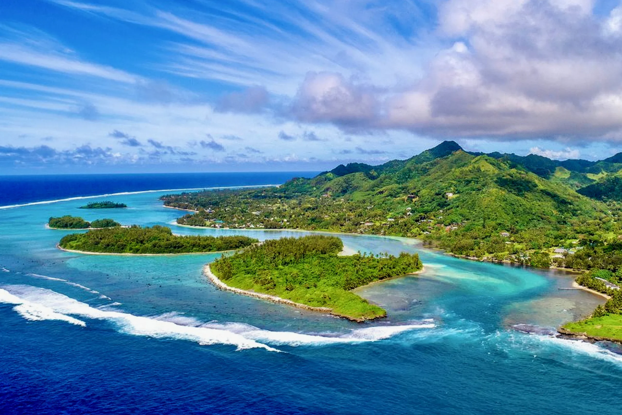
The attraction is straightforward: leave the northern side of the island, climb through the forest beneath Te Rua Manga, the Needle, and descend towards the southern coast. Within a few hours, the mountain that formed the background to your arrival becomes something you have moved through. But the island does not fit into a morning. A morning gives you a way into it, provided you leave enough room for weather, uncertain footing and the ordinary pleasure of stopping.
Planning The Rarotonga Cross-Island Walk
Rarotonga’s coastal road circuit is approximately 17 Nm. That describes the road around the island, not the effort required to cross its interior. The through-walk is roughly 3 Nm, depending on the vehicle drop-off and collection points. On level ground that distance might hardly require planning. Here, roots, steep slopes and stream crossings turn a short line into a substantial walk.
Three to four hours is a reasonable walking estimate in favourable conditions for people comfortable on rough ground. It is not a return time to promise the yacht. Transport, pauses, finding the correct entrance and a slower descent all sit outside the neatness of that estimate. We would keep the rest of the day loose rather than attach lunch, a departure or a difficult connection to the earliest possible finish.
The usual north-to-south direction gives the day a clear shape, but a route description is no substitute for checking the track’s current condition locally. Heavy rain, fallen vegetation or damaged markers can alter what yesterday’s directions mean. A local guide is valuable for more than finding the way: knowing where people commonly miss a turn, how the streams respond and when the ground has become unsuitable is knowledge worth paying attention to.
For a visit from Discovery, the first decision happens before anyone puts on walking shoes. The yacht must have a suitable place to remain, and the return arrangements must work if the walk takes longer. Avana and Avatiu are not interchangeable answers to that problem. Harbour access, clearance, berth suitability and exposure need their own assessment. We cannot choose where to leave a large sailing catamaran from a hiking itinerary.
From The Coast Into The Catchment
The coast encourages a horizontal understanding of Rarotonga: road, buildings, beach, lagoon, reef. The interior interrupts it. Rarotonga is a volcanic island, with ridges and valleys shaped by erosion, rather than a low coral atoll. Walking inland makes that distinction physical. Water has cut routes down the mountain; the path must find its own way across and between them.
Under a close canopy, shade does not necessarily mean relief from heat. The breeze that made the waterfront comfortable may no longer reach your skin, while humid air slows the evaporation of sweat. A shirt can become wet without any rain falling. When the slope steepens, the sensible response is to shorten the stride and ease the effort before overheating makes the decision for you.
This is also where the forest becomes more than scenery. Damp leaf litter cushions some steps and conceals others. Ferns occupy the low light. Moss holds moisture on surfaces that may already be slippery. A bird can be audible for some time without ever becoming visible. There is no need to supply a species name to justify standing still and listening, and no reason to leave the path to obtain a better photograph.
The mountain and lagoon belong to the same water system. Moist air rising over high ground cools, helping cloud and rain form; runoff then travels downhill through the catchment. Forest cover and roots help hold soil in place. After heavy rain, sediment can be carried towards the coast. The practical consequence for a walker is modest but important: stay on the established track rather than cutting a new line down a wet slope. What happens above the road does not remain above the road.
At The Foot Of Te Rua Manga
Te Rua Manga reaches about 413 metres above sea level. That is the elevation of the Needle, not a statement that the through-track takes walkers to its summit. The distinction matters. Reaching the area beneath the rock and climbing the rock itself are different undertakings, with different exposure and consequences. The cross-island walk does not need a summit attempt to be complete.
From the coast, a volcanic pinnacle is a shape against the sky. Close beneath it, the shape breaks into surfaces: weathered rock, vegetation finding purchase, steep faces that are difficult to judge from below. Erosion has removed material around the harder remnants of the island’s volcanic structure. The result looks abrupt because the wearing away has not happened evenly.
Where the canopy opens and the cloud allows, the view gives the body a useful explanation of its effort. The lagoon lies below the folded land rather than beside it. The road that seemed to organise the island becomes a narrow coastal convenience. It is worth stopping somewhere secure, letting the breathing settle and looking without trying to include the next stage of the walk in the same moment.
Cloud may obscure much of that view. We would not hurry onto exposed ground to catch a brief opening, or treat a photograph as compensation owed for the climb. Any ropes or other fixed aids encountered on steep ground also require judgement; their presence alone does not establish their condition or make a route suitable. Staying on the through-route is a perfectly satisfactory decision. There is already enough here to occupy the attention.
The Rarotonga Cross-Island Walk In Wet Weather
Rarotonga’s warmer, wetter season generally runs from November to April. May to October is usually cooler and drier, but neither period guarantees a dry track. Rainfall is a pattern, not an appointment. A bright coastal morning can coexist with cloud over the heights, and the state of the soil may owe more to the previous day’s rain than to the sky above breakfast.
For this walk, recent rainfall matters alongside the forecast. Wet roots become less forgiving, steep earth loses purchase and streams may rise. A shower that feels pleasantly cooling near the road can have a different significance in a narrow drainage farther inland. The question is not simply whether we mind getting wet. It is whether the route remains sensible for the people walking it.
Persistent or heavy rain is a reason to choose another day. A swollen, fast or discoloured stream is a reason to stop and reassess, not to assume that a marked crossing must still be usable. Water can be rising from rain upstream even when the immediate sky looks harmless. An early start creates more room for a slow pace and an early retreat, but it does not make unsuitable weather suitable.
This is familiar reasoning aboard Naora. Sven, our founder and captain, plans every weather window and sails every leg himself; the shore plan has to sit within that wider judgement. Wind and swell affect the yacht while rain affects the mountain, and the same day may be acceptable for one activity but not the other. We would rather leave the walk undone than make a departure time the reason somebody hurries across bad ground. The freedom to change the plan is useful only if we actually use it.
What We Carry And What We Leave Alone
Footwear matters more than elaborate equipment. A sole needs to grip wet earth and uneven rock, and the shoe needs to stay secure when the foot is angled across a slope. Smooth-soled deck shoes are designed for a different surface. Boots or trail shoes should already be comfortable; a steep descent is a poor place to discover that a heel slips or a toe presses against the front.
For an adult, 2 to 3 litres of drinking water is a useful starting allowance for planning a walk of this length in tropical conditions, not a universal requirement or a guarantee of enough. Heat, pace, body size and time on the track change the calculation. Carry sufficient water from the start rather than relying on streams. If the conditions call for more than someone can comfortably carry, shortening or postponing the walk is better than quietly accepting a shortage.
A light rain layer belongs in the pack, although wearing it throughout a humid climb may trap more heat than it saves in discomfort. A phone protected from water, an offline route, a small first aid kit and a torch address different problems; none replaces telling someone the intended route and expected return. Food should be easy to eat during a pause. The useful pack is small enough to leave both hands free, with its weight sitting close to the body.
Before leaving the yacht, clean soil and seeds from footwear. Moving between islands gives that small habit particular value. At the trail approaches, follow the established access and respect local directions rather than treating gardens, cultivated ground or a convenient-looking shortcut as public space. Everything carried in comes out again, including fruit peel. The forest does not need souvenirs of our good intentions.
Coming Down To The South Coast
The descent deserves energy kept in reserve. Going uphill makes the work obvious through breathing and heat. Going downhill asks the legs to control each step while fatigue is already present. Shorter steps help keep the body over the feet; reaching far forward onto a wet root does the opposite. It is sensible to stop on secure ground before looking at a view rather than trying to walk and look simultaneously.
In damp forest, the sound can seem closer than the landscape. Water moves somewhere below the path. A shoe releases from soft earth with a small pull. Leaves continue dripping after rain has stopped. The shoulders may be warm beneath the pack while the hands feel cool where they have touched wet rock. These are ordinary sensations, but they make a distance memorable in a way that its measurement never will.
The southern descent leads towards a waterfall area and then out towards the coastal road. Trail exit, road and lagoon should not be imagined as one convenient point. Allow for the remaining access walk, and arrange collection in advance rather than assuming a taxi will pass when required. An agreed meeting place and a plan for delay are especially useful when mobile reception cannot be taken for granted.
A waterfall pool is not automatically an invitation to swim. After rain, rising water, debris and uncertain footing can make staying out the sensible choice. Nor does everyone need to complete the crossing to have a worthwhile day ashore. For a family or a mixed-ability party, route choice should reflect the least confident person’s comfort on steep, slippery ground, not only the strongest person’s stamina. A separate, simpler plan is kinder than making the whole day an exercise in keeping up.
Back To Discovery
There is practical work between the end of the path and settling aboard. Mud comes off footwear before it reaches the deck. Wet things need somewhere to dry. Drinking water and an unhurried meal matter more than immediately filling the remaining hours. After a humid climb, shade and moving air may be all the afternoon needs. Leaving that space is part of planning the walk well.
Discovery, the Lagoon Eighty2 sailing the Naora Global Expedition, continues around the world beyond the Cook Islands. People joining through Naora’s private circle choose where along that route they step aboard, when it fits their lives and how long they stay, one week or many. They do not need to reproduce the same days ashore. A walk through the interior may be central to one person’s Rarotonga and entirely absent from another’s.
What interests us about the crossing is the connection it creates between land and water. A cloud resting on the ridge is easier to understand once you have felt how damp the forest remains. A stream reaching the coast has an upstream landscape attached to it. The island ceases to be only the outline visible from a yacht, without pretending that a few hours have made us familiar with its life.
If the walk fits the conditions, there is pleasure in returning without another appointment waiting. The shoes can dry. The light can change on the slopes. Behind the pale water of the lagoon, there is now a path whose steepness you know underfoot.