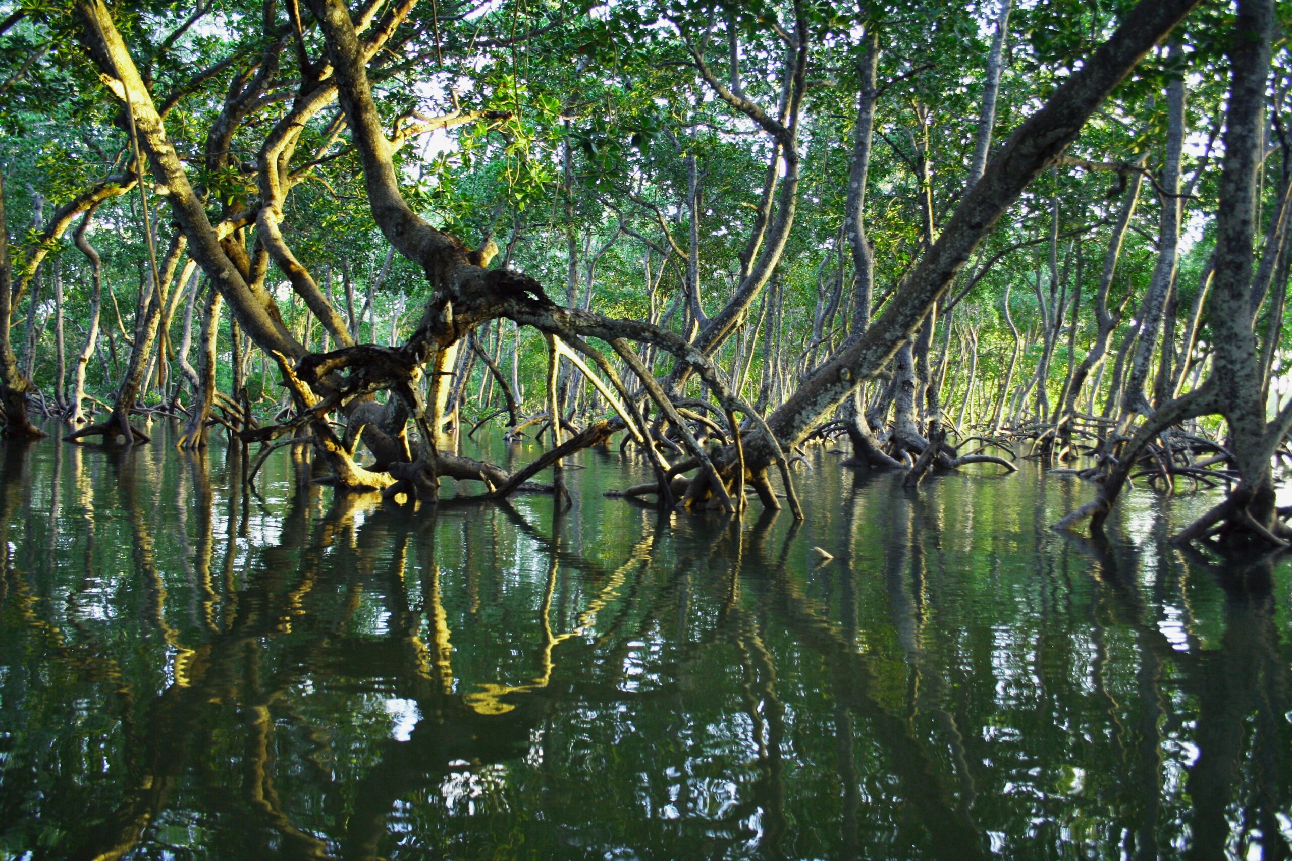
A wet line on a mangrove root tells us where the water has been, not where it will be when we come back. In East African mangroves, that distinction can determine the whole tender visit. The creek ahead may look comfortably deep while a sill crossed near its entrance is already losing the water needed to get home. Nothing in the shaded reach ahead necessarily announces the change.
For the East African coasts on Naora’s route, this is where our planning begins. The attraction is easy to understand: water narrowing between trees, the light broken into small moving patches, a coastline that becomes more interesting as we slow down. But the useful question is how much of that water remains available to a loaded tender throughout the visit. The return passage has to exist before we leave Discovery. It must also remain possible without damaging the place we came to see.
The Return Route Through East African Mangroves
A mangrove visit has more than one entrance. There is the opening visible from the sea, the navigable channel through the sediment, and the legal and local permission to use it. Those boundaries do not necessarily coincide. A creek can be physically accessible and still lie within a protected area, support fishing activity that should not be interrupted, or lead towards homes where a tender full of cameras would be an intrusion.
We therefore need more than an attractive shape on a chart. The practical information concerns the shallowest connecting reach, any restrictions on powered boats, where local traffic passes, and what has changed recently. Heavy rain can alter the flow and carry debris into a channel. Sediment can move. A remembered passage through a creek is useful knowledge, but its age matters.
Local boat handling deserves attention without being copied uncritically. A lightly loaded boat with its propulsion arranged for shallow water may cross somewhere our tender cannot. Its operator may also be accepting a wait for the next tide because home is nearby. Neither its track nor its confidence establishes our clearance. The useful conversation is about the bottom, the water level and the return, rather than simply asking whether a boat can get through.
The most important place to identify is often unremarkable: a broad, shallow stretch between deeper reaches. It is this connecting ground that sets the visit’s limit. Once across it, the reassuring depth farther inland can make it easy to forget. We want it marked in the passage plan, together with a place to turn before it and the conditions that would make us decline the crossing altogether.
Tidal Windows In East African Mangroves
Much of the East African coast has predominantly semidiurnal tides, broadly two high waters and two low waters in a lunar day. The typical interval between successive high waters is about 12 hours and 25 minutes. That explains why yesterday’s useful access time cannot simply become today’s departure time. It does not provide a tide prediction for an individual creek.
The prediction must apply to the right locality, date and time convention. We also need to distinguish water height from current. High water at a coastal reference point does not mean the water has stopped moving inside an estuary. Narrow entrances, branching channels, freshwater discharge and the volume stored among the trees can keep water running when an offshore tide curve suggests the level is near its peak.
Spring tides, associated with new and full moon and often following them with a local delay, generally bring a larger tidal range. That can offer more depth around high water while also producing stronger flows and a more substantial fall afterwards. Neap tides may bring gentler currents but fail to cover the same sill sufficiently. More tidal range is not automatically a better visiting window.
Entering on a rising tide often gives a useful recovery margin: the general direction of change is towards more water. Yet it can also conceal the channel boundaries, cover low banks and tempt a tender into flooded forest that will later drain. We favour an established channel with room to manoeuvre over the greatest possible penetration at the highest possible water.
The turning time comes from the limiting depth on the return route, with an allowance for delay, rather than from dividing the period around high water into equal halves. Tide levels do not rise and fall at a constant rate. Wind and recent rainfall can also make the actual level differ from the prediction. If the water observed at the entrance disagrees with the plan, we revise the plan. We do not explain the discrepancy away because the tender is already loaded.
The Depth A Tender Actually Needs
The tender’s hull is not necessarily its deepest part. With an outboard in its normal operating position, the lower unit may be the controlling depth. People, fuel, equipment and their distribution change how the boat sits. A draught remembered from an empty tender beside the yacht is not an operating figure for a full boat travelling slowly through uncertain water.
Consider an illustrative calculation, not a measurement of Discovery’s tender. There is 1 metre of water over a sill. The loaded boat and its propulsion require 0.5 metres, and the plan retains 0.3 metres beneath the lowest part. Only 0.2 metres of falling water remain before that planning limit is reached. What looks like a metre of access is, in practical terms, a much smaller allowance. The clearance in this example is not a universal recommendation; an uncertain bottom or submerged obstructions may demand considerably more.
A depth display is useful only when we know what it displays. A reading below the transducer is different from depth below the hull or depth referred to the surface. An incorrect assumption about the offset can consume the entire margin. Nor does an echo sounder necessarily describe the bottom ahead of the propeller. In very shallow water over soft sediment, an ambiguous return should reduce our confidence, not encourage a more convenient interpretation.
Trimming an outboard up can reduce its reach into the water, but it is not permission to keep going until something touches. Beyond the equipment’s proper operating limits, cooling water supply, thrust and steering can be compromised. People shifting seats or wash from another boat can change the clearance again. Our limit needs to leave room for those ordinary movements.
This is also why we record the least depth encountered where it matters, with its time and tidal context. A breadcrumb track records where a boat travelled. It does not record a promise that the same water will still be there.
Reading Soft Sediment And Narrow Channels
At a shaded bend, the glare can disappear so abruptly that the water seems easier to read. Then the bottom remains invisible anyway. Suspended sediment and dissolved material from the forest can colour it brown, while reflected leaves make a pale patch look dark. The body relaxes in the shade before the navigation has become any simpler. Water colour alone is a poor depth sounder here.
We look instead for several clues that agree: the shape of exposed banks, the direction of surface flow, the way floating leaves turn at a junction, and the depth trend along the known channel. Flow may scour a deeper route around a bend, but branching tidal creeks do not obey a simple rule that every outside bank is safe. A submerged root or fallen branch can occupy water that is otherwise deep enough.
Soft mud sounds forgiving until a boat settles into it. A probing pole can penetrate sediment and suggest more usable water than actually exists. A propeller can stir a cloud that removes the remaining visibility, cut into the bed and still fail to move the boat. Increasing power after touching bottom is therefore a particularly poor reflex. The first response is to stop driving into the problem, assess the contact and prevent further damage.
Stepping out is not an automatic solution either. Mud may not bear a person’s weight, and submerged roots, sharp debris or local animal hazards may make wading unsafe. A planned visit cannot depend on passengers pushing the tender across a drying sill. If a grounding nevertheless occurs, the response depends on tide, stability, exposure and the available assistance, not on a determination to maintain the afternoon’s timing.
The cost of leaving a little earlier is a shorter visit. The cost of treating mud as spare clearance can include damaged equipment, damaged habitat and people waiting in heat where they were never meant to wait.
Slow Speed And Working Against Current
Slow travel gives the person at the helm time to interpret the water and gives everyone else a chance to notice the place. It also reduces the wake reaching soft banks. But the lowest possible throttle setting is not always the safest one. A tender still needs enough control to avoid being set sideways into roots, and current can make its speed over the ground quite different from its speed through the water.
Take another planning example. A distance of 1 Nm at 3 knots through still water takes 20 minutes. With a 1 knot current directly against the boat, the same distance takes 30 minutes at the same through-water speed. Those extra minutes belong in the return calculation. They cannot safely be recovered by making more wake through a sensitive reach. The permitted or appropriate creek speed may be lower still.
We judge our wake by looking behind us, rather than trusting the impression of gentleness at the helm. A modest ridge spreading from the stern can steepen as it reaches a shallow bank. Propeller wash can disturb sediment without much visible surface wake at all. Keeping to an adequately deep channel and leaving space from the bank matter alongside throttle position.
In a confined reach, switching the engine off to create silence can surrender the control needed to maintain that space. There is no virtue in drifting quietly into a root system. We would only stop propulsion where there is room, a understood drift and a reliable way to resume control. Otherwise, the quieter experience comes from steady, restrained operation rather than an absolute absence of mechanical sound.
You feel the difference in your shoulders when acceleration stops and the boat settles into a consistent pace. Small sounds begin to separate from the engine note: water against the tube, a splash under the bank, leaves moving above the channel. Maintaining control is what allows attention to move beyond the boat.
Keeping Clear Of Roots And Wildlife
The edge of a mangrove forest is not a wall of interchangeable vegetation. Some trees support themselves with arching roots; others send breathing roots upwards from the sediment. Those exposed structures help trees occupy ground that is regularly flooded and poorly supplied with oxygen. Their apparent toughness is no reason to use them as mooring points, handholds or something to push against with a boat hook.
Roots also slow water and help retain sediment. The spaces among them can provide feeding grounds and shelter for juvenile fish and other small animals, although the species and use vary between places. At high water, fish may move into ground that was exposed earlier. As the tide falls, that available habitat contracts towards channels and pools. We are entering a working tidal system, not a permanently submerged garden.
There is no honest universal wildlife distance for every creek and every animal. Local restrictions set the minimum where they exist. Behaviour can require more room: a bird interrupting its feeding to watch us, repeated retreat along a bank, or animals changing direction to avoid the tender. By the time something takes flight, we may already have been too close. The response is to stop approaching and create distance without pursuing it from another angle.
The bank is often best watched obliquely from the channel rather than approached head-on. Binoculars can bring detail closer without bringing the boat closer. Remaining still in an appropriate position gives small movements time to become legible, a crab leaving cover, a fish turning under an overhanging root. These are possibilities, not sightings owed to us.
The same restraint belongs around people. Fishing gear needs a wide berth, landing places need to remain usable, and a face appearing between the trees is not permission for a photograph. A creek can feel secluded to visitors while being part of someone else’s ordinary working day.
Returning Before The Channel Closes
Before a tender leaves Discovery, someone remaining aboard needs to know its intended area, its return limit and what will happen if contact is lost or it is overdue. That agreement should not rely solely on a mobile signal. Radio contact can also become less dependable behind terrain and vegetation. The response to a missed check-in needs to be understood before the first bend takes the yacht out of sight.
Fuel sufficient for the adverse return and a reserve, drinking water, sun protection, suitable lifejackets and the helm’s engine stop cord are ordinary preparations. So are checking the means of communication and carrying equipment appropriate to the visit. None becomes less necessary because the trees make the water feel sheltered. A creek can hide the wind that will still be waiting on the open-water crossing back to the yacht.
The return limit is whichever constraint arrives first: depth over the sill, worsening weather, insufficient daylight, fuel margin or the comfort of someone aboard. A person struggling with heat is a sound reason to shorten the visit. So is a current stronger than expected. The plan should make those decisions easy to take without anyone feeling that an expedition has somehow failed to deliver its afternoon.
On the way out, we continue reading rather than merely retracing. A falling level can expose the edges that were submerged on entry, but it can also narrow the usable channel and strengthen the flow through a restriction. Passing the limiting sill does not finish the navigation. There is still the creek entrance, the open water and the transfer back aboard Discovery.
What interests me about this kind of visit is how little its value depends on reaching the farthest point. Once the return is properly allowed for, there is room to spend time in an ordinary reach without looking past it towards the next bend. The tender can remain clear of the bank. A bird can continue feeding. The creek does not need us to reach its end.